Every serious Dholera investor eventually asks the same question: why here? Why did India choose these 22 villages — not Rajkot, not Surat, not Vadodara — for its largest greenfield smart city?
The answer is 1,500 years old. And it has everything to do with water.
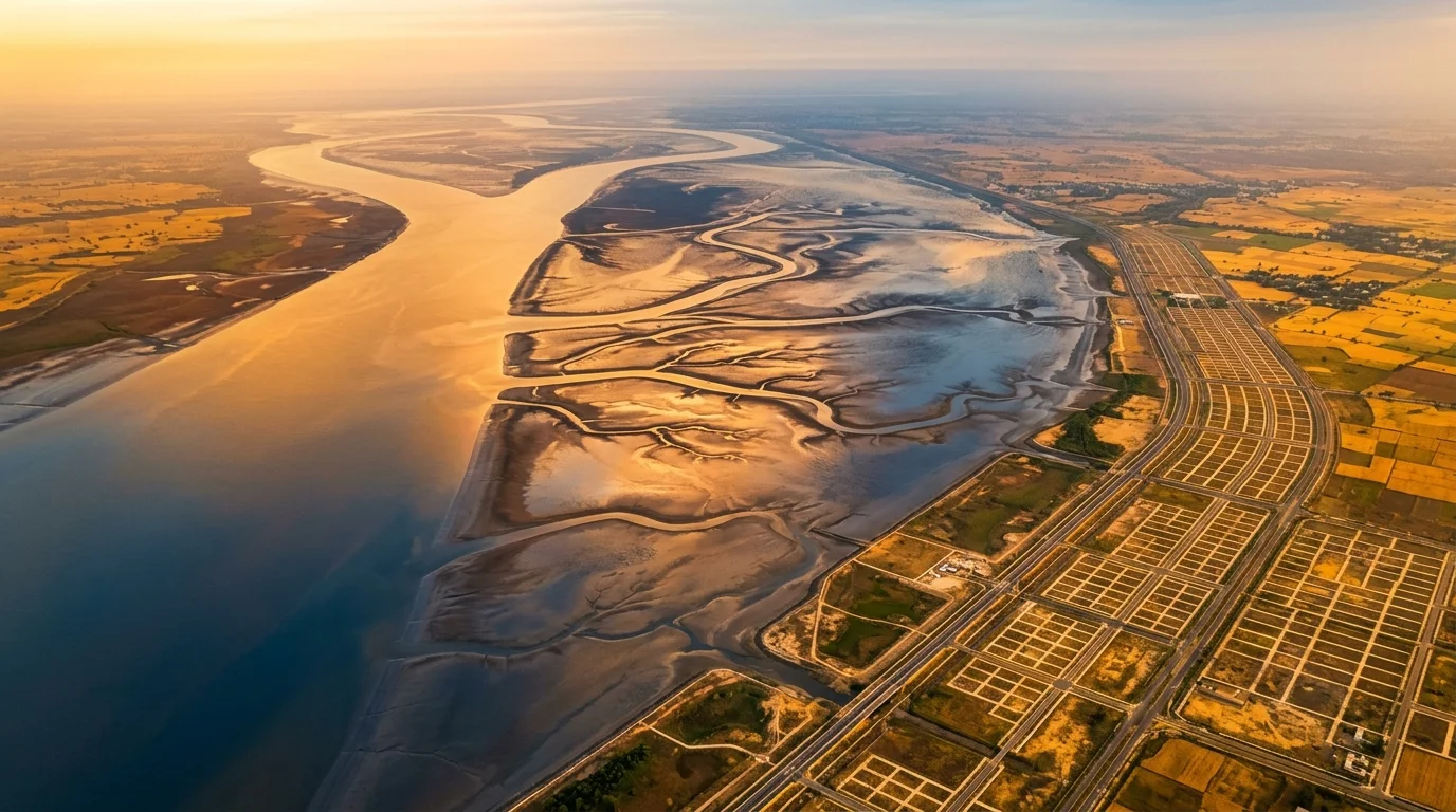
The Gulf of Khambhat — Arabia Sea's Gateway Into India's Heartland
The Gulf of Khambhat (also called Gulf of Cambay) is a funnel-shaped inlet of the Arabian Sea along Gujarat's western coast. It narrows inland toward Ahmedabad — India's richest state's largest city and commercial capital.
This geography is not incidental. For over a thousand years, the Gulf of Khambhat was India's most important maritime gateway. Ships from Arabia, Persia, Africa, and China entered India through this funnel. Goods flowed in both directions: Indian textiles, spices, indigo, and precious stones out; gold, horses, and foreign goods in.
The Arab traveller Al-Masudi visited in 913–914 CE and recorded that the region "enjoyed great fame for its semi-precious stones, which were very popular in the markets of Aden, Mecca, and Baghdad." Marco Polo visited in 1293 CE and noted it as a busy port. Ibn Battuta in 1340 remarked on its cosmopolitan character.
From the late 900s to the 1500s — six consecutive centuries — the Gulf of Khambhat was the Indian subcontinent's dominant maritime corridor.
Dholera Village: Port Town on the Same Gulf
Dholera is not a name that planners invented for a smart city. It is the name of one of the 22 villages in the SIR boundary — and it was chosen because of its history.
Dholera village was a functioning port on the Gulf of Khambhat, with a flourishing trade in textiles, spices, and commodities that continued into the early 18th century. Archaeological findings at Dholera confirm human habitation dating to the Harappan period (~2500 BCE), and the port was active through the medieval era under the Chavda, Solanki, Delhi Sultanate, Gujarat Sultanate, and Mughal periods.
Its decline — like Khambhat city itself — came from silting of the river channels and shifting trade routes in the early modern era. The same natural process that ended one chapter is now being reversed by modern engineering.
Planners did not place the name "Dholera" on this SIR arbitrarily. They chose it because this village and this coastline have been India's maritime entry point for millennia.
Ahmedabad's Missing Port — The Problem That Dholera Solves
Gujarat has the longest coastline in India — 2,340 km (revised official figure, Ministry of Ports, 2024). It has 48 ports. Kandla, Mundra, Hazira, Dahej, Pipavav, Bhavnagar — Gujarat's coastline is one of the most port-dense in the world.
Yet Ahmedabad — Gujarat's capital, its largest city, and one of India's most important commercial centres — has historically had zero direct port access.
- 📍 Ahmedabad to Kandla (nearest major port): ~192–300 km
- 📍 Ahmedabad to Mundra: ~287 km
- 📍 Ahmedabad to Hazira: ~160 km
- 📍 Ahmedabad to Dholera SIR (Gulf of Khambhat): ~100 km
- 📍 Dholera to Hazira: ~65 km
Dholera is not just closer to water than any alternative — it sits on the Gulf of Khambhat itself. It gives Ahmedabad its first genuine coastal industrial access in the modern era.
For a city of Ahmedabad's commercial scale to lack sea connectivity is a structural economic constraint. The Delhi–Mumbai Industrial Corridor was designed specifically to remove this constraint.
DMIC Needed a Sea Node — and Only One Location Made Sense
The Delhi–Mumbai Industrial Corridor (DMIC) is a 1,504 km industrial spine from Delhi to Mumbai, jointly backed by India and Japan. Its purpose: create world-class industrial cities at regular intervals along India's busiest freight route, connected to ports, power, and rail.
For the DMIC to function, it needed a node that could connect Delhi → Ahmedabad → sea. Ahmedabad is unavoidable — it is Gujarat's economic capital. But without a sea node near Ahmedabad, the corridor terminates inland.
The planners looked at the map. The Gulf of Khambhat sits directly south of Ahmedabad. These 22 villages — the Dholera taluka — are flat, large enough for a 920 km² planned city, and on the coast. No alternative location offered this combination.
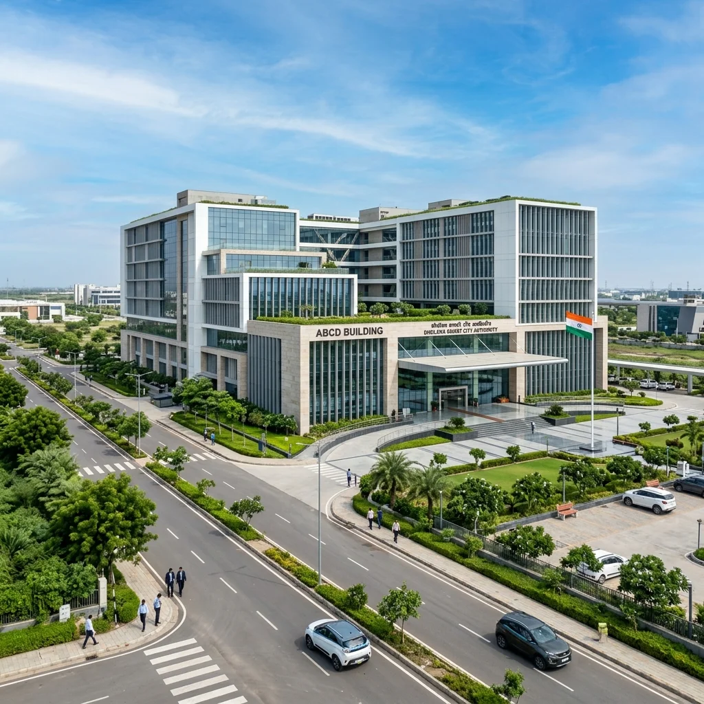
On January 6, 2009, the Gujarat Government declared this 22-village area a Special Investment Region under the Gujarat SIR Act. DSIRDA was constituted to govern it. A joint SPV — DICDL, 51% Gujarat government + 49% Government of India — was formed to develop it.
The choice was not bureaucratic. It was geographical inevitability.
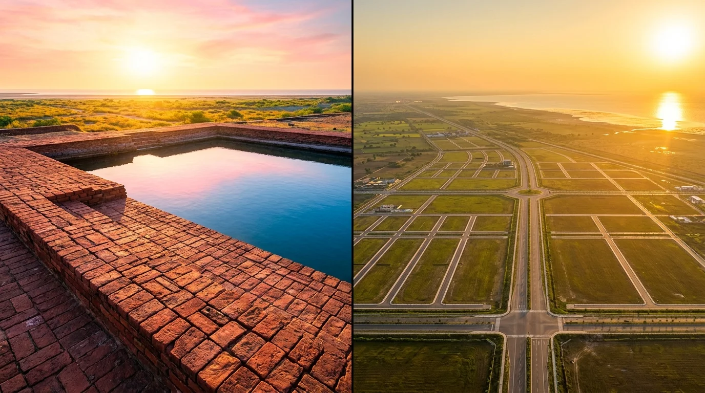
Lothal: The 4,400-Year-Old Confirmation
36 km from Dholera SIR sits Lothal — one of the most significant archaeological sites in India. Lothal was an Indus Valley Civilization port town, active from approximately 2400 BCE to 1600 BCE. The Archaeological Survey of India excavated it beginning in 1955 and found the world's earliest known purpose-built dock — a 37m × 22m trapezoidal basin connected to an ancient river channel leading to the Arabian Sea.
Lothal traded with Mesopotamia and Egypt. Indus seals have been found at Sumerian sites. National Institute of Oceanography confirmed marine microfossils at the dock site — it was real, functional, and global.
In September 2024, new geophysical studies re-confirmed the ancient dockyard's existence.
The same coastline that hosted the world's oldest dock in 2400 BCE is now hosting India's largest smart city in 2026. This is not coincidence. Geography does not change.
The National Maritime Heritage Complex (NMHC) — a ₹4,500 crore government project being built at Lothal — will become the world's largest maritime museum by area when complete. The new semi-high-speed rail project (Cabinet approved May 13, 2026) includes a dedicated 20.4 km spur directly to Lothal NMHC and Dholera Airport.
The Five Reasons This Location Was Chosen — Summary
- 🌊 Gulf of Khambhat access — Direct coastal access for Ahmedabad, India's most port-deprived major city
- 🏭 DMIC sea node requirement — DMIC needed Delhi → Ahmedabad → sea; Dholera is the only viable location
- 📐 Scale availability — 920 km² of flat, developable land adjacent to the coast — rare in India
- 🏛️ Historical maritime identity — The region's trade credentials go back 4,400 years; infrastructure follows proven geography
- ⚡ Renewable energy potential — Gulf of Khambhat coastal winds + flat land = 5 GW solar park already under development; Tata Power commissioned 300 MW Phase 1 in April 2022
No other location in India offered all five simultaneously. Dholera was not chosen — it was the only answer.
What This Means for Your Investment Decision
Most Dholera investors focus on the catalysts: expressway, airport, Tata semiconductor, semi-HSR rail. Those are real and they matter.
But the deeper reason to be confident is the geography. The catalysts come and go — timelines slip, projects delay. The geography is permanent. Ahmedabad will always need coastal access. The Gulf of Khambhat will always be there. The DMIC corridor will eventually complete. And when it does, the industrial and residential demand for land in this 22-village zone will be structural — not cyclical.
Rajpath Supreme 2 — bulk window currently open at ₹725/sqft — sits in this zone. Same RAV Group that delivered 150% on Supreme 1 (₹400 bulk → ₹1,000 retail in 14 months). Same location. The geographic thesis unchanged.
Want to understand the location in person?
Saurabh arranges free site visits from Ahmedabad — expressway, airport, NMHC Lothal site, project plots — in one day.
Zero brokerage · No sales pressure · See it before you decide