It is the most common concern from first-time Dholera investors: "The area is near the coast. Is it safe from flooding? What about cyclones?"
It is a legitimate question. The honest answer is more nuanced — and more reassuring — than most people expect.
The Short Answer
Dholera SIR has low flood risk compared to India's most flood-vulnerable cities. It has real cyclone exposure that is managed by construction standards, not ignored. And the government's ₹18,000 crore trunk infrastructure investment explicitly includes a comprehensive storm water drainage network designed for the full 920 km² SIR.
1. Flooding — What the Geography Actually Shows
India's highest flood-risk cities — Mumbai, Chennai, Kolkata, Patna — share a common characteristic: they sit on river deltas or low-lying coastal plains at or near sea level, with rivers that overflow into dense urban areas during monsoon.
Dholera SIR does not fit this profile:
- 📐 Terrain: Flat but elevated above the tidal zone — the SIR boundary sits above the inundation line of the Gulf of Khambhat
- 🌊 Drainage direction: Natural gradient runs toward the Gulf — floodwater drains outward, not inland
- 🏗️ Infrastructure drainage: DSIRDA Phase 1 trunk infrastructure includes a dedicated storm water network across the SIR's activated zones
- 📋 CRZ compliance: All development follows Coastal Regulation Zone norms, which mandate minimum elevation and setback from the high-tide line
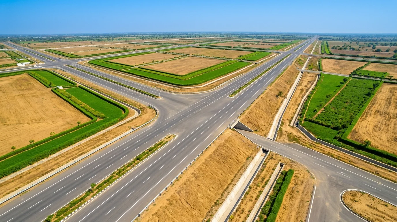
- 🛣️ Expressway elevation: The Ahmedabad–Dholera Expressway (inaugurated March 31, 2026) is elevated in flood-sensitive sections, acting as a drainage buffer
The Gujarat government's Dholera SIR master plan — prepared by AECOM — specifically addressed drainage in the context of a coastal city. The drainage network is one of the seven trunk infrastructure systems being funded by the central and state government.
2. Historical Record — Has Dholera Flooded Before?
No major flooding incident has been recorded in the Dholera taluka in the past two decades. The Gulf of Khambhat coast has high tidal variation, but tidal flooding and riverine flooding are different phenomena.
Compare this to Mumbai (floods multiple times per monsoon), Chennai (catastrophic floods in 2015, 2021), and Patna (Ganga overflows annually). Dholera has not appeared in NDMA's high-risk flood zone classifications for Gujarat. The districts flagged for serious riverine flood risk in Gujarat are primarily in the north — near the Tapi, Narmada, Mahi, and Sabarmati river corridors — not on the Dholera coastline.
3. Cyclone Risk — The Real Concern, Addressed Honestly
This is where we must be straightforward: the Gujarat coast is in India's cyclone belt. Cyclones do form in the Arabian Sea and occasionally make landfall on the Gujarat coast.
Recent examples: Cyclone Tauktae (May 2021, Category 4 equivalent) made landfall near Diu — ~200 km from Dholera. Cyclone Vayu (June 2019) passed ~50 km offshore.
How this risk is managed in Dholera SIR:
- 🏗️ Construction standards: All DSIRDA-approved structures must meet IS 875 Part 3 (Wind Load) standards for the coastal zone — designed for 150+ kmph wind speeds
- 🛡️ Airport standard: Dholera International Airport is built to ICAO Annex 14 standards for wind and storm resistance
- 🔌 Underground utilities: The SIR's master plan routes all power, telecom, and water underground — eliminating the overhead line damage that causes most post-cyclone disruption
- 📡 Early warning: IMD cyclone tracking has 72-hour landfall accuracy within 100 km — sufficient lead time for precautionary measures
The cyclone risk is real. It is also manageable and already designed for. The Tata fab — a ₹91,000 crore facility with precision semiconductor equipment — is being built to standards that take this risk into account.
4. What About Sea Level Rise?
Long-term: Gujarat's coast, like all Indian coasts, will face sea level rise pressure over the next 50–100 years. For a 3–7 year investment horizon (the typical Dholera plot holding period), sea level rise is not a relevant risk variable. The SIR sits above the 1-metre flood contour in current projections.
The Bottom Line for Investors
- ✅ Flood risk: Low — no riverine flood exposure, natural drainage to Gulf, planned storm water network
- ⚠️ Cyclone risk: Real but managed — construction standards address it; underground utilities reduce post-cyclone disruption
- ⏳ Sea level rise: Not relevant for 3–10 year investment horizon
- 🏗️ Infrastructure confidence: ₹91,000 Cr Tata fab, international airport, NMHC — none built without thorough natural hazard assessment
Want to see the site in person?
Saurabh arranges free site visits from Ahmedabad — see the expressway, airport, and terrain yourself.
Zero brokerage · No sales pressure · Your questions answered in person